Victorian Landcare Magazine - Summer 2018, Issue 71
The Bureau of Meteorology’s Australian Landscape Water Balance website provides information on soil water storage within a region, as well as reporting on current and past soil moisture and runoff conditions.
The website gives interactive access to data, such as estimates of current and historical root-zone soil moisture, for any location in Australia. Clicking on or searching for a locality or catchment will show a daily time-series (up to yesterday) of root-zone soil moisture, evaporation or rainfall for a day, month or year.
The website can also compare daily or monthly root-zone soil moisture values against the historical record, which commenced in 1911. Other variables, such as soil moisture at different depths, deep drainage to groundwater, runoff to surface water, potential and actual evapotranspiration, and precipitation (rain, hail and snow), can also be accessed.
Landowners and other land managers can use information from the Australian Landscape Water Balance website to analyse the current and historical water conditions on their land and compare it to other areas.
For example, a landowner in Omeo could compare the root-zone soil moisture in the area at the start of November 2017 with the start of January 2017 and see that the soil moisture has dropped from 35 per cent to 13 per cent in a period that would normally see the major increase for the year. Looking back further, the landowner can see it has not been that dry in Omeo since the end of 2009.
"Landowners and other land managers can use information from the Australian Landscape Water Balance website to analyse the current and historical water conditions on their land and compare it to other areas."
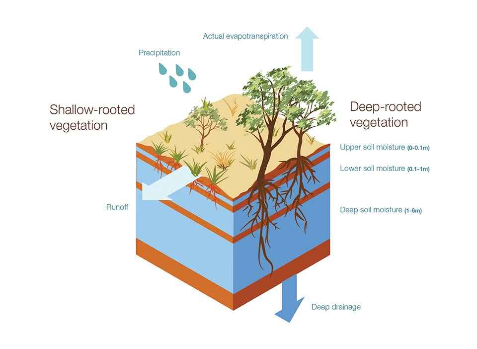
The information on the website comes from the Australian Water Resource Assessment–Landscape model (also known as AWRA-L), developed by the Bureau of Meteorology and CSIRO.
The model simulates the flow of water through the landscape from rain to the movement of water through the vegetation and soil and then out through evapotranspiration, runoff or deep drainage to groundwater.
AWRA-L is a nationally consistent modelling system that simulates water flows at a spatial resolution of 25 square kilometres (a 5x5 km grid). This means data can be compared from grid squares more than five kilometres apart, to see the differences occurring in the local landscape.
Visit the Australian Landscape Water Balance website www.bom.gov.au/water/landscape to find out how your region is tracking compared to others, and put current conditions in a historical context.
For more information contact the Australian Landscape Water Balance staff at the Bureau of Meteorology by email awrams@bom.gov.au