Victorian Landcare Magazine - Winter 2018, Issue 72
Mornington Peninsula Landcare Network
The Mornington Peninsula Landcare Network’s Greens Bush to Arthurs Seat Biolink project, funded through the Victorian Government’s Our Catchments, Our Communities initiative, involves revegetation and restoration of indigenous vegetation on 20 private properties between two significant patches of remnant vegetation.
As part of the project, we wanted to visually represent the change in vegetation quality of patches of remnant bushland on the properties that fenced bushland from stock and/or engaged contractors to tackle exotic weeds.
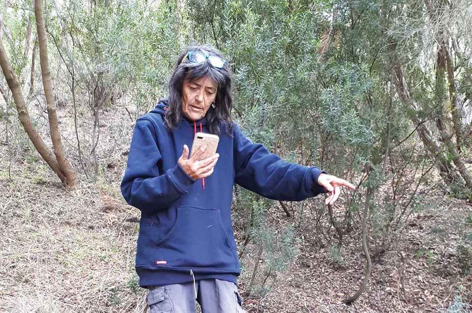
The Port Philip and Westernport CMA provided additional funding for local ecologist Gidja Walker to undertake vegetation quality assessment (VQA) on a number of these properties. Using a smart phone with the Google app My Maps, Gidja mapped vegetation quality by colour-coding patches of vegetation as she walked across the properties. Other phones and apps can also be used in vegetation quality assessment.
VQA is a useful technique for visually representing the quality of an area of native vegetation. It can be used to track changes over time in response to vegetation management or a disturbance. It takes into account all vegetation storeys, from ground layer to canopy.
A useful assessment technique
VQA is a useful technique for visually representing the quality of an area of native vegetation. It can be used to track changes over time in response to vegetation management or a disturbance. It takes into account all vegetation storeys, from ground layer to canopy.
It can be used to compare the quality of vegetation in different areas, guiding where to prioritise effort for effective weed control. It can also examine the response of an individual plant species to management actions or a disturbance.
The process involves mapping areas of vegetation based on the percentage of weed cover, ranging from Category 1 (undisturbed sites of highest quality) to Category 4 (severe disturbance and low diversity). The quality of the vegetation is based on the amount of weed invasion.
Gidja used a four-colour code system for easy identification of different areas using the following guide:
Category 1: Green. Areas of bushland virtually free of exotic plants where native plant communities display structure, species composition and diversity typical of those in non-urban areas. Average indigenous cover greater than 75 per cent.
Category 2: Blue. Areas of bushland with moderate infestation of exotics and/or invading native alien species. Average indigenous cover 50–75 per cent.
Category 3: Orange. Areas where bushland is severely infested by exotics and/or invading native alien species and where the regeneration of dominant species of that community are being significantly suppressed. Average indigenous cover 25–50 per cent.
Category 4: Red. Areas where bushland has been almost completely replaced by exotic species or bushland where only overstorey species remain and regeneration is absent due to exotics invading the understorey. Average indigenous cover 0–25 per cent.
These categories can be adapted to different vegetation types and providing you define what the colour represents, additional colours can be used.
The findings can then be used to determine the appropriate management action using the three Rs – retention, restoration or revegetation.
The findings can be used to determine the appropriate management action using the three Rs – retention, restoration or revegetation.
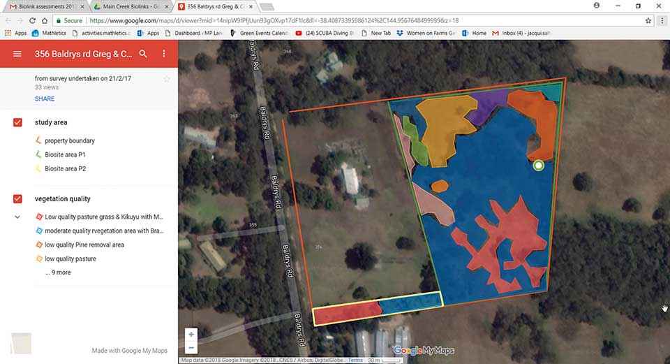
Above: Vegetation quality assessment of a property in the Greens Bush to Arthurs Seat Biolink by Gidja Walker in February 2017. This map of the property shows how additional detail can be provided in the legend using different colours. The maps were popular with landholders, who could see the benefits of mapping over time.
According to Gidja Walker there are a number of considerations when using VGA.
Avoiding bias
“While VQA is a relatively quick way of assessing the quality of bushland, it does involve a certain amount of subjectivity. “To estimate the percentage of exotic cover requires the assessor to make a judgement. To avoid bias, it’s best to use the same contractor to undertake mapping over time and undertake VQA in the same season.”
Gidja also points out that VQA does not take species diversity into consideration, and cannot be used to examine individual species.
“Other methods such as quantifying species in quadrats may be useful if this level of detail is required. Whilst it does indicate the quality of habitat, it does not consider particular habitat features such as hollow logs,” Gidja said.
One of the landholders involved in the project, Greg Holland, has been undertaking restoration on his property, using the four-colour code system and the three Rs.
According to Greg, a careful survey at the beginning of the work is essential.
“Gidja’s VQA mapping is an excellent way of setting out the details in the field in a short time. Patience really is a virtue.
“Following the removal of weeds, we have had long-dormant seeds sprout to provide plants not seen in the area for years. Our small wetland has not only recovered mostly by itself, rare species such as the floodplain fireweed (Senecio campylocarpus) are now thriving in one of the transient water holes,” he said.
Further information on VQA can be found in the Bush Regenerator’s Handbook published by the National Trust of Australia. Go to www.practicalecology.com.au for more information on the three Rs.
Jacqui Salter is the Landcare Facilitator for the Mornington Peninsula Landcare Network. Her position is funded by the Victorian Landcare Facilitator Program.
Contact Jacqui at jacqueline.salter@mornpen.vic.gov.au